Foreword
Ok guys, I’ve been in Huaraz for more than two weeks, it’s been more than ten days since I last published an article, and it’s time to check in! To be frank I have a whole lot of them still in the works, that only need a few adjustments before they can be published, and most of them are still about Lima. That is, in my opinion, and unlike what you might have heard, this city really is worth your attention!
But today there’s something more urgent! Among all the trips you could consider taking when staying in Huaraz (many of whom I already have since I’ve been here for a long time now, and I know I always repeat myself, but I promise I will tell you about them in another article, with less details) there is one that clearly stands out: the Santa-Cruz trek! And I definitely need to tell you about this adventure while it’s still fresh, because it really was an amazing experience! But let me give you some context before that, or at least a few prerequesites, since you’ll have more context about Huaraz and its surroundings in another article.
- Huaraz is a rather big city, located 3000 meters above sea level, at the entrance of a massif called the Cordillera Blanca (no need for a traduction here I guess), which itself is part of the Andes Mountains.
- The city itself isn’t renowned for being especially interresting from a tourist point of view. Still you can definitely enjoy staying there! This is the case for me by the way, to such an extent that it’s becoming hard to finally leave it. But as for visiting, studying history, architecture, and so on, the city doesn’t have, at first sight, much to offer.
- Nevertheless, Huaraz is located very close to the Huascaran park, a Peruvian national park designated World Heritage Site by UNESCO, in order to protect the riches of the cordillera blanca. You can therefore easily guess that a lot of wonderful places can be found in this park, and that Huaraz being the big city nearby, it ended up being used as the starting point of the various excursions that let you discover these places. Hence the substantial tourist inflow!
- Among all the potential excursions in the cordillera blanca, there is one in particular you will certainly hear about if you are heading for Huaraz: the Santa-Cruz trek! As for me I had never heard this name when I was on my way to Huaraz (by the way I don’t even remember how I chose going to that city…I must have seen photos of the laguna 69 on the internet and decided to head for Huaraz when I understood I had to go through it to see the laguna), and a couple of young French people I met when taking the bus (Hi there if you’re reading this!) told me about it for the first time!
- For most hikes, the classical way of doing things is booking the hike in one of the countless tour operators here in Huaraz, who will not fail to approach you should you be passing by their agency walking too slowly. But I can’t complain about that since in the end this is how I visited the laguna 69, and it was great! You should indeed know that this isn’t, at least in general, a tourist trap! It’s just that a rather sophisticated logistic is required for many of these hikes (or visits), whose starting point is often a very small village located dozens of kilometers away from Huaraz, and whose end point is sometimes different from the starting point. This is also why most hotels and hostels act as middlemen between you and the tour operators.
When I integrate a map like the one above, you’ll find the scale in kilometers at the bottom (next to « Conditions d’utilisation », except maybe on cell phones), and also the icon in the top left corner (to the left of the map’s name) that allows showing the detailed list of markers I’ve put on the map, the lines I drew, etc. That is, potentially useful information 😉
Okay I think we’re done with the prerequesites. Let’s now dive into today’s main topic: the Santa-Cruz trek! Just like many other excursions, people usually book this trek with a tour operator. Firstly because, once again, you have to go far away from Huaraz and the hike’s end is a one-horse town different from the other one-horse town it started in (so even if you have your own car, that won’t help a lot). But also because this is a 4 days hike, without any shelter on the trail (so you are completely on your own during the whole trip), and you will be going through high altitude passes, which are, to a large extent, responsible for the trek’s relative difficulty. Tour operators therefore provide you with a guide, food, donkeys to carry all the stuff…
But you know me, I don’t like doing things as everybody does… Actually I don’t remember precisely how or why I started considering doing the trek on my own, but it’s a mix of the following things:
- I had the feeling that booking the trek with an agency would have made the adventure less authentic. That in a way I would be taken by the hand and shown what the Santa-Cruz was like, but that it would therefore introduce some distance between me and the real adventure. To put it differently, I thought the difference would be similar to the one that exists between seing wild animals in a zoo and seing them…in the wild! That comparison really is excessive, but you get the idea!
- The occasion to find myself alone into the wild, for several days, not depending on anybody and with only myself I could rely on, was of course a little more attractive to the solitary person inside me than the prospect of trying to enjoy the trip while having to fit in a group if I booked with a tour operator (wait for what comes next before you frown).
- Hiking with a group means collective decision-making, in particular when it comes to planning the route. In other words it wouldn’t have been up to me to decide whether to deviate from the main path in order to see other potentially beautiful landscapes.
- Doing this trek on my own represented a hell of a challenge from a sports, and perhaps even human, perspective! I think this last component was one of the most important leading to my choice, to such an extent that during the trek I sometimes forgot to enjoy the beautiful scenery, because I was focusing on the challenge I was overcoming. Once again, you are completely on your own during a whole 4 days — you have to be able to rely on yourself only, in an environment most of us really aren’t used to! And it might not seem much when I say it this way, but you will see in the next parts that it’s not that easy. Having donkeys carrying most of the stuff I would need would therefore have made the challenge much less…challenging! Or, I would have needed to take care of the donkeys myself, ensuring their well-being and so on, and…well, you know, I don’t really plan on becoming a professional mule-driver! Same thing with the idea that someone would cook for me: it would have made me feel less like I survived thanks to my own efforts!
- And finally, let’s tell the truth, doing the Santa-Cruz on your own looks badass! Precisely because it is such a great challenge! Like a girl I met on another hike said: « It sounds so wicked! »^^
Minor digression here, since we’re talking surviving on your own in the wild, to suggest you take a look at the following Youtube channel: Primitive Technology. In a nutshell that’s a guy alone in the forest (nothing very juicy so far, I concede that 😛 ) that builds everything he needs to survive, using local materials only. In other words he’s on a completely different level: I had brought a tent, and cutlery for eating (for instance), whereas he builds a house, with a heating system inside. He makes a foundry and extracts metal from soils! And during another hike I met a girl that came from Russia and knew this channel — it’s dumb but I found that very cool! Anyway, we don’t really care about all that… End of the digression!
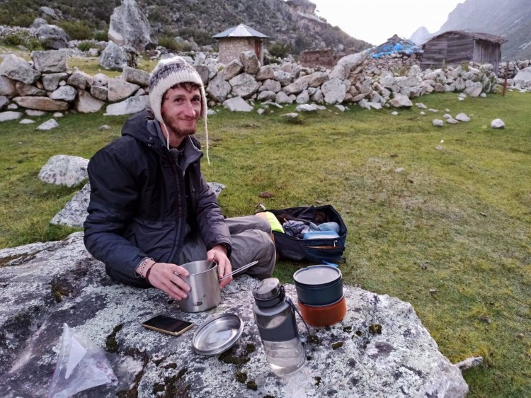
Photo Credit: Alena 
Photo Credit: Primitive Technology
Let’s just take a small step back to say that I’m not crazy: plenty of people do the Santa-Cruz trek on their own. You don’t need to be superman, and by the way I used this blog, and then that one, as sources of inspiration during my preparation. It’s not that dangerous, especially as the chances are high that you’ll cross other people’s path, since it is a very renowned trek. Nevertheless, within my capacity and with my few previous trekking experiences, that was still a great challenge!
Preparations
Before telling you about how the trek went day by day, I propose that we do a quick review of the itinerary and my preparation, starting with a little anecdote. The latter will contain spoilers of some highlights of the hike, but hey, who cares since in the end I decided no to submit the script to Netflix? 😛
After making up my mind and deciding to do the trek solo, I needed to rent some stuff: tent, sleeping bag, camping mattress, and camping stove. I had been lent a sleeping bag before my departure to Peru, but the latter clearly isn’t able to protect me from the potentially cold temperatures you might face during this trek. As for the tent and all the rest, bringing them from France would have been a terrible waste of space in my bag, since I can rent all that the few times I need it. I therefore went in search for a shop where I would be able to rent my equipment, and after a few failed attempts, I was finally directed toward a store where I could rent rather than buy. This store, however, ended up being more of a tourism agency, and they did not seem to be in the habit of renting their camping equipment if you did not book the whole tour with them… And no this is not the anecdote yet, otherwise this would really be a boring one!
After telling this agency about my situation, they finally considered renting the stuff to me, and gave me a price which was definitely ad hoc, even though they still told me how much each item contributed to the grand total. But I thought they were not very friendly, quite cold instead, and their price seemed expensive to me. In hindsight I realize it really wasn’t — about 60€ for 4 days — but let’s say you get used to everything being very cheap here…so that I told them I wanted to compare with their competitors, and immediately went somewhere else. The following store that I found seemed much better: they were very professionnal, renting camping equipment clearly was as part of their business, and their price was very attractive. In addition, some friends I had met in Huaraz (the ones who run the restaurant where you can pay with bitcoins, right next to my hotel, but that’s another story for another time…) had told me in the meantime that they could lend me all the cooking stuff, so that in the end I didn’t even need to rent that. I therefore went out of this second store with all my camping equipment ready. Phew! it was already late and I intended to start hiking the next day in the morning…

I only needed some nice-but-not-too-much picture to give you a break — but still without distracting you too much from what I’m saying — before we can go on with the story!
So here they are: very cute baby donkeys that I saw during the trek.
…Although I could take advantage of this moment to state that the donkeys that carry hikers’ camping stuff might also have been this cute when they were babies…are you sure you want them to carry 50 kilograms bags? 😛
And now comes the spoiler I warned you about in the beginning. During the hike — the second day to be precise — I met a group of hikers, that had embarked on this trek with a tour-operator, that is with a guide, donkeys, and so on. We inevitably started talking since we were going through the same hassle, and we ended up getting along so well that in the end I was kind of part of the group! I walked almost a day and a half with them (until we split ways because I wanted to take a slightly different route), I took part in the group pictures and, while coming back to Huaraz, I was even allowed into the tour operator’s bus even though I hadn’t paid anything! Then I was invited to have a drink with the group — including the guide — the evening we came back to Huaraz, in a bar located right in front of the tour operator’s store. The meeting point was set at the store, 7PM.
When we finally made it back to Huaraz, I felt a little embarassed by all that kindness, so I obviously helped unloading the bus and carrying their stuff back to the store. What a surprise, when I reached the store that the guide was telling me to put the stuff in front of, to realise that it was the same store as the one I had tried to rent my equipment from in the beginning! The embarassment suddenly turned into awkwardness, as I had not really left them in good terms… As you could expect, the guy I had been talking to a few days ago looked at me slightly disdainfully. Fortunately Isabella was there — this super cool Brazilian girl with whom we hit it off as soon as we met during the trek, and because of whom I am now seriously considering including Brazil into my itinerary! — so that I could discreetly share my discomfort with someone!
There it is, the anecdote, in case you were too distracted to notice!
But let’s come back to organisational subject matters: after renting the camping equipment from Akilpo (I put a link to this shop’s website just in case, this could be useful!) I still had some shopping to do, notably the food (pasta, cereal bars, dried fruits, etc), and a few gadgets to buy, like a flask, or a watch, even though I had brought some of them from France (binoculars, compass, …). I won’t go into detail here, and will rather post a link to the full list I had prepared at the bottom of this page, once I have formatted it a little — this too could be useful (at least for me)! Just know that I had this small tool that makes a big difference: the Lifestraw. It’s a filtering straw that enables you to drink the water from whatever sources when you’re hiking, and this is really, really handy! Thanks to that I didn’t need to bring a lot of water…in theory at least. But obviously, my uselessly excessive carefulness led me to bring at least 3 litres of mineral water regardless, divided between the flask and the bottles… Same with the food: not only had I enough of it left for at least 2 additional days when I finished the trek, but also I had bought so much that I couldn’t pack it all and had to leave some of it at the hotel! Yeah…I’m always afraid of being hungry!^^
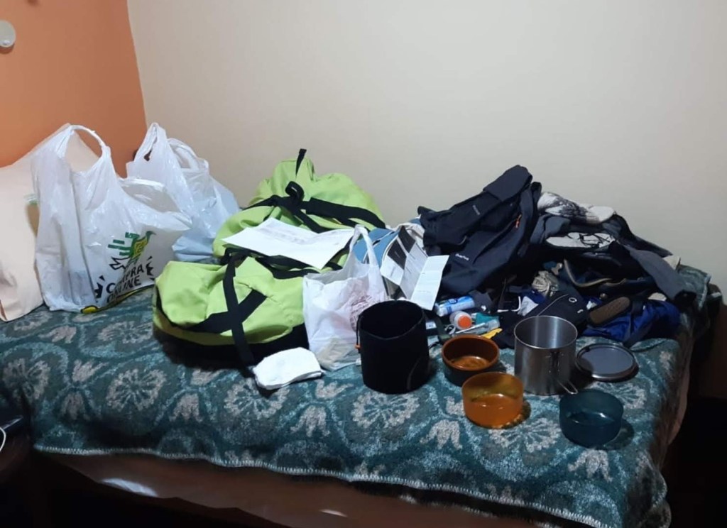
How can you put this… 
and this… 
into this!
Let’s now talk a little about the itinerary: this too can be important! One thing to keep in in mind though, is that the itinerary I will present here is not the only option. Various alternatives can also be chosen. In particular some people chose to do the Santa-Cruz in the opposite direction, and several detours also exist that make the trek longer. What I’ll explain therefore only describes what I’ve done — but it’s the most classic route though.
- So, « my » Santa-Cruz starts in a backwoods town called Vaqueria (approximately 3500 meters above sea level), and ends 4 days (3 nights) later in another backwoods town, Cashapampa (2900 meters a.s.l).
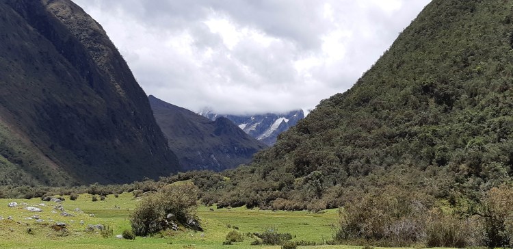
- The highest point of the trek, named Punta Union, is reached on the second day, and is located 4750 meters a.s.l. This is almost as high as the Mont Blanc, which is kind of a reference for the French… This pass offers a spectacular viewpoint over the surrounding summits (notably the Artesonraju that peaks at 6025 m above sea level and is said to have inspired the Paramount’s logo), as well as the splendid Taullicocha lake…if the weather is on your side! And know that these names, many of which are Quechua words, and that I solely cite for the sake of being accurate even though I myself have trouble trying to remember them, will be illustrated later with beautiful pictures 🙂
- On the third day, a usual detour of a few hours enables you to reach the shore of another mountain lake — the Arhuaycocha — just as splendid as the previous one, and from where you also have a wonderful view on the Alpamayo — once again if the weather is on your side — considered by some to be the most beautiful mountain in the world, and sometimes climbed by the most seasoned mountaineers (but definitely not by me!).
- After this small detour you come back down to camp in Llamacorral, located 3800 meters a.s.l, and you finish the trek the next day with an approximately 3 hours walk to go to the small Cashapampa town.
Finally, since the trek neither starts nor ends in Huaraz, going to the starting point of the hike, strictly speaking, required using public transport, and so did going back from Cashapampa to Huaraz on the last day. But I would rather include that in the « day by day » account of the journey, because from my perspective, it really felt like a part of the excursion.
The above map is a topographic map, which means it shows a detailed representation of relief. And if you manage to zoom adequately — that is sufficiently but not too much, not that easy… — you can even get the contour lines showing the exact elevation, which enables seeing where the difficult parts are, on which day(s) the biggest climbs and descents are crossed, and so on. For those of you that might be interested 😉 Also, you can’t see it on the Google Map, but almost all of the itinerary was along rivers and torrents. That was both very pleasant, and practical.
At last, now we’re good and ready to delve into this famous hike! So fasten your seatbelt and get ready for a rough take-off! Okay maybe I’m exaggerating a little…what I mean is that here we are, no more teasing: in the next part I’ll finally tell you about how the trek went!
Day 1 – A tough start!
♪♪♪Theme songs♪♪♪
Hymn #101 – Joe Pug
Oyasumi – Lomepal
Piany Pianino – Thylacine
Before my departure for Peru, I had been given two travel diaries. I thought they were very great gifts, all the more so as each one had been livened up with a few words written on the firts pages by the person that had given me the diary, which added a personnal touch I really appreciated, so thank you again. The reason I’m sharing this with you is that I had brought one of these diaries during the Santa-Cruz, and that to tell you about the hike’s beginning, I propose copying here what I wrote in the diary at the end of the first day…
The 12/02/20: First day of the Santa-Cruz
5:50 PM: Finally sat down « in the warm » inside the tent. Not that hard to put up after all!!!I’m dead — really I can’t do no more! While putting up the tent, each time I stood up I felt like I was about to faint! I must say that I slept less than one hour last night. Not that great the night before a trek. All because of my shit organisation: I ended packing up my stuff at ~4 AM.
The collectivo’s departure was at 5:30 AM…
And it’s been a very long day — transport from Huaraz to Yungay, then to Vaqueria in another collectivo (very long and turbulent). Then the walk itself: I didn’t stop at the first camping site, I pushed until the second, or third one (they’re not really official) in order to save a little time for tomorrow, which is supposed to be a much harder walk. I don’t know how I’m gonna do, my bag really is too heavy, it’s freaking me out a little. I already have stiffness in my shoulders because of it — so much that it’s hard to write — and I feel like walking with it on significantly compresses the top of my spine. That is even though the bag is well adjusted and I gave up on bringing some things I wanted to, but it’s just…too heavy. I try to reassure myself by thinking it’s supposed to get less heavy as the trek goes on.
I feel incredibly lazy to start cooking, but I should rather do it soon, as I need energy, and sleeping. Thanks again to Moisés for the portable stove and all the cooking stuff, it’s really convenient for me, they’re very handy!
See you!
Excerpt from my travel diary, written after putting up the tent on the first evening.
PS: Elevation ~4020m
PS2: The landscapes were wonderful, and the wildlife really stunning!!! But I’ll talk about that another time (it’s really worth it), right now I’m simply too exhausted for that!!!
And some time later, once the night had fallen and my stomach was full, as you can guess with what I say and the slightly happier tone:
It’s simultaneously freaky, and sooo cool to be camping alone right in the middle of the Huascaran park. Let’s hope a cow, an alpaca, a horse or even a donkey, is not gonna come an eat my tent during the night!
Still from the diary, and yes I’m copying exactly as it was written there, in order to try to make this a little authentic 😉
As you’ve probably understood by now, the first day was quite difficult. Mainly because of the weight of my bag, but I don’t know the extent to which the fact that I was so tired also played a role. The day had indeed started at around 5 in the morning with a ride in collectivo from Huaraz to Yungay (another town which, just like Huaraz, acts as a kind of gateway towards the Huascaran park, but less significant than Huaraz, even though it is closer than the latter to many excursions’ starting point). Just in case, a « collectivo », which I think is also called « combi » since I couldn’t notice any difference between the two, is a kind of minivan/minibus. They constitute the vast majority of the public transport system here in Peru. And you had better not taken that collectivo too late because it’s quite a long ride, and once in Yungay you have to change and take another collectivo to go until Vaqueria, the actual starting point of the hike. But that second collectivo only offers two departures each day…which makes sense since Vaqueria and the other stops are in really small villages, so I guess there isn’t a lot of demand — but that means you must be very careful not to miss these two departures!

Here’s a combi.
But they’re often a little smaller…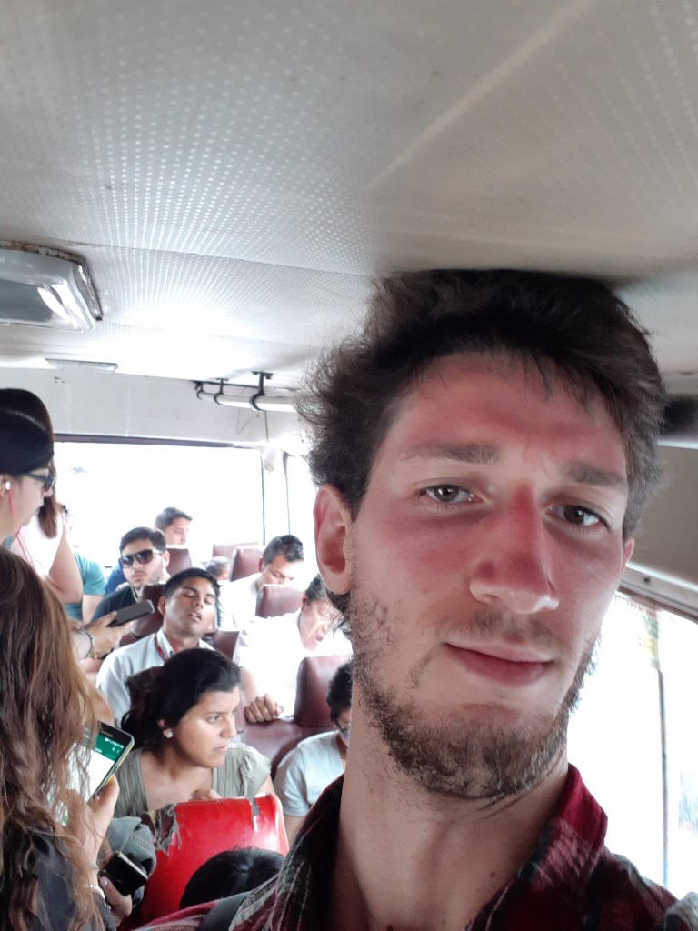
…and since I’m very tall, if there’s no seat available and I therefore have to stand up, I have to lower my head otherwise it hits the ceiling! 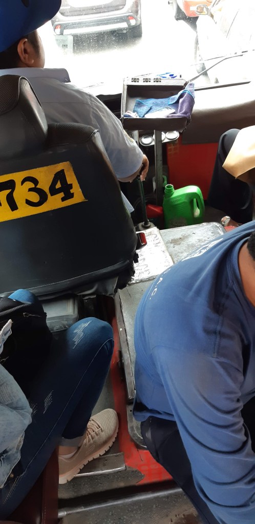
The organization inside can be quite haphazard!
The second collectivo takes a very uneven non-concrete road, hence the « turbulent » I wrote in the diary: it really tosses you every which way — only once you’ve been through it can you understand what I mean! But this ride also offers a splendid viewpoint over a great number of mountains, cliffs and mountain lakes — in particular the Llanganuco lakes, from where the Santa-Cruz used to start before the mountain « road » was extended. It takes nearly 3 hours to reach Vaqueria, so you can be a little stunned once you finally get there, because you’ve been tossed around in every direction for so long, but at least it gave me enough time to get to know two Israeli guys at first, and then to have a long discussion with a Peruvian woman that lives in a small village even further than Vaqueria. With the latter we talked about a lot of different things, from livestock and the cows’ size (they are bigger in France than they are here) to the significance of Italian (or on a different note Venezuelian) immigration in Peru, by way of a discussion about our respective families, the Quechua language, and even a comparison of religious beliefs between Peru and France. That was very interesting.
As for the two Israeli guys, they had met a few days before during another, much harder, trek: the Huayhuash. They had not planed on doing the Santa-Cruz, but instead to ride down with their rented mountain bikes the road we had just been climbing in the collectivo, which also promised to be a thrill! They therefore got off once we reached the highest point of the itinerary (named « Mirador: Lagunas Llanganuco » on the map above), way before Vaqueria. When I understood that their bikes had been tied up on the combi’s roof, probably above all the bags, and mine in particular, I started thinking that this brownish liquid that had been flowing on the window for a moment must have meant that the small chocolate-milk cartons in my bag had burst (yeah I know, I didn’t bring the most lightweight « food » 😛 ) — I really freaked out! In fact, when we reached Vaqueria, everything was fine in my bag, and I could therefore start the hike with peace of mind.
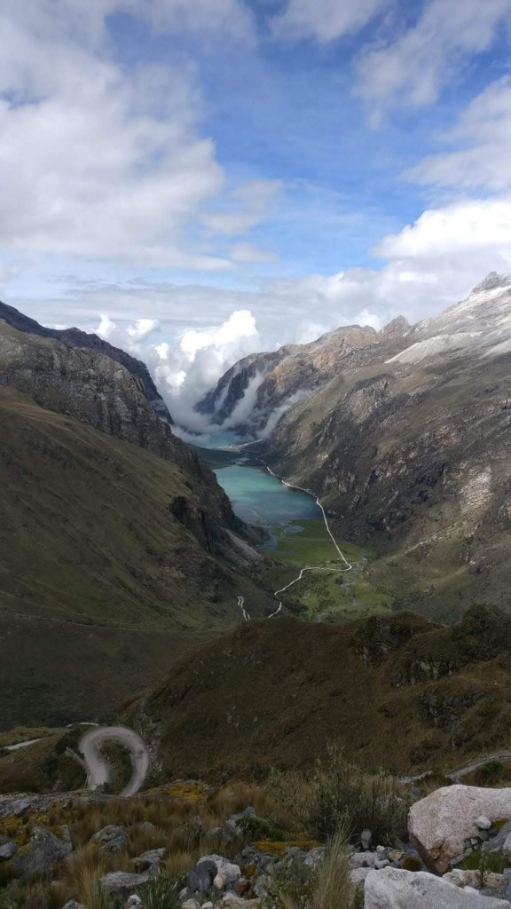


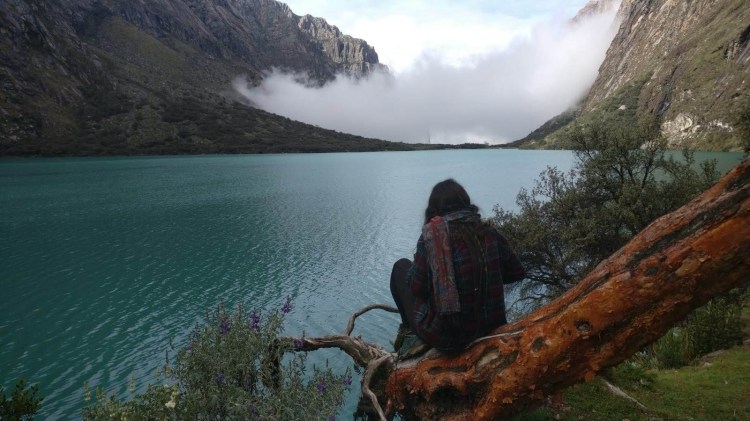
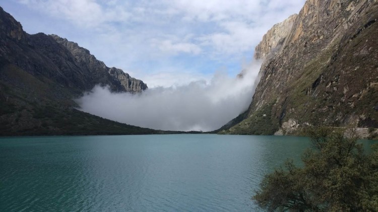
Photo Credit: One of the guys in the group, whose name I forgot…sorry!
When I finally got off the combi in Vaqueria and started walking, the idea that I was beginning this 4 days trek for real, completely on my own (I still thought at that moment that I might not cross anyone’s path during the whole trek!) suddenly became much more tangible. And that’s a weird sensation: a little surrealistic, and kind of similar to the one I felt when I left for Peru, but to a lesser extent though.
About the walk, you do not immediately start the ascent towards Punta Union, but instead the route first goes down quite steeply, so that what you think is that climbing will be all the more painful afterwards… When you then start going up again, you cross small hamlets, which I don’t quite know if they’re part of Vaqueria, but where you encounter a great deal of farming animals almost walking around freely: sheeps, goats, chickens, donkeys, and all kinds of pigs! I didn’t know such a variety of the latter existed, and the bigger ones are sometimes so quiet that you don’t even notice them…until you reach their level, and then they can startle you with their grunt (no, I’m not gonna try to make you believe they’re guard pigs, as I did with the cats in the First Days In Lima‘s article, I promise).
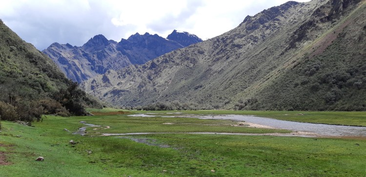
Then the hamlets become more and more spaced, until they’re completely gone, and a few moments later you reach a checkpoint to buy your ticket, which allows you to get into the Huascaran park strictly speaking. And it’s there, in a gigantic pasture that lets you rest a little because the route there is flat, that you start discovering the impressive wildlife I talk about in my diary! I think that was the first time I saw horses running around completely free! I mean, they weren’t in an enclosure, however big it could have been, neither were they temporarily allowed to gallop in an open space, no, they lived there! In that gigantic space where nobody came to annoy them — assuming visitors of the Huascaran park are respectful and there aren’t too many of them, which was clearly the case on that day since I only met two people, the first of whom seemed to work for the park management.
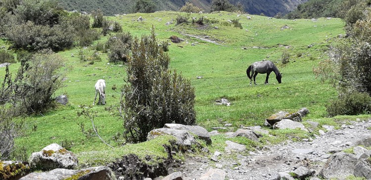

But horses were not the only inhabitants of this wide pasture delimited by the surrounding mountains. Sheeps, donkeys, and especially cows and bulls, were numerous too. I even think that I saw two llamas playing cat and mouse (or running after each other at least 😛 ).
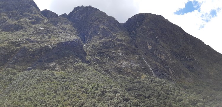
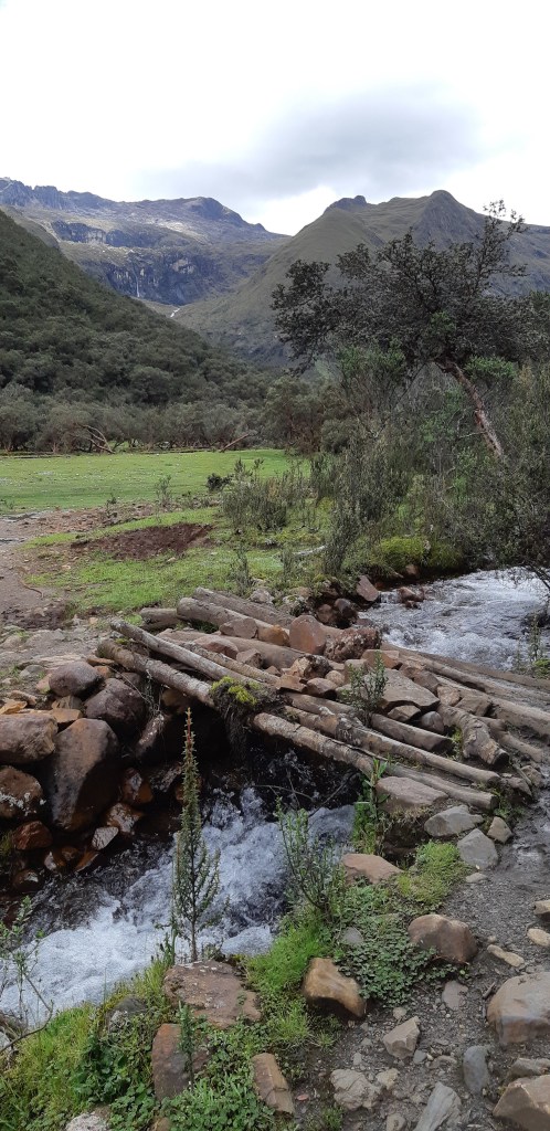
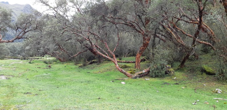
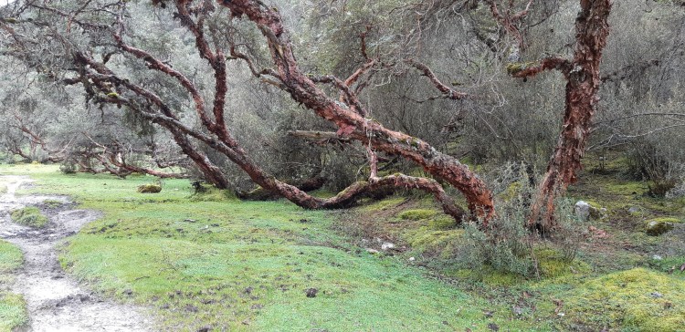
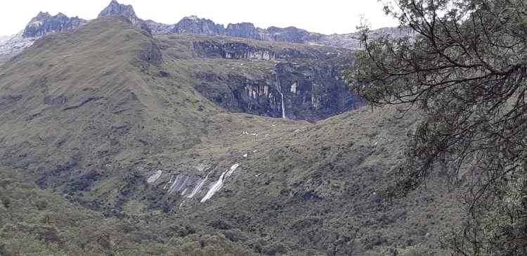
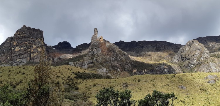
The landscapes were very beautiful too: the mountains and their relief still full of Polylepis at that altitude (one of the most « altitude-proof » trees in the world according to Wikipedia, and the local guides), the countless little cascades that you can see in the distance falling in the middle of these mountains’ relief, the small brooks flowing between the pasture’s weeds (sometimes so discretely that you really have to be watchful to be able to notice them), but also all these reddish stones in the rivers, likely results of an oxydisation whose origin I don’t understand. But at this point I’d rather let you look at the pictures, which clearly aren’t enough to give you a sense of how impressive this was (and in a way it’s better like that, as someone lately told me, otherwise it wouldn’t be worth visiting anymore), but will still do a better job than my words, however inventive I try to be.
First, here are some of the animals I was telling you about:
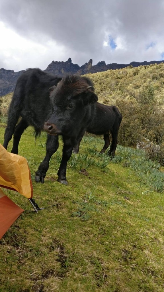
Photo Credit: Again this guy whose name I forgot… 
The horses! 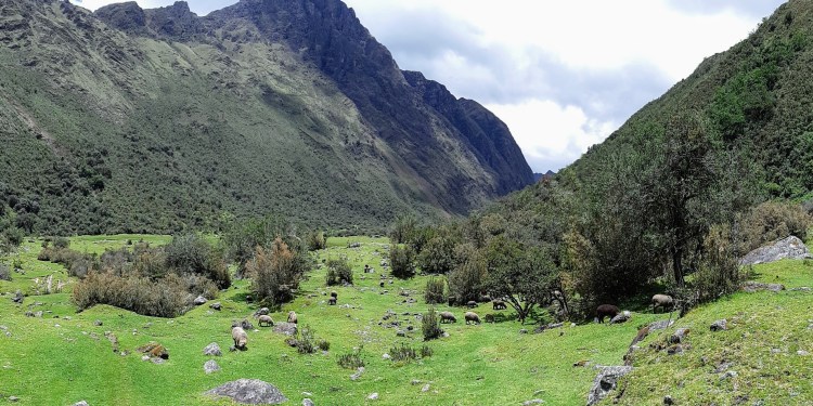
They’re hiding among the rocks, but there are sheeps everywhere! 
Horses again… 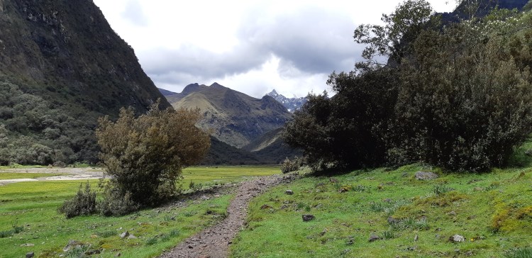
You can’t see them well because of the (bad) quality of the picture, but far away in this pasture were almost all of these animals, gathered together in one place.
Then a few pictures of the landscapes:

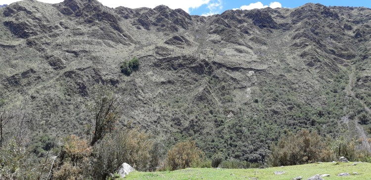
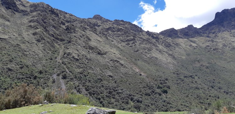
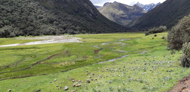


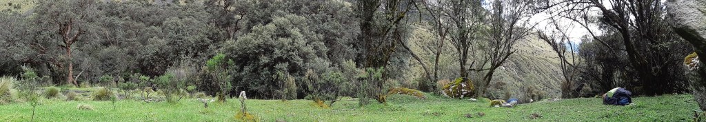
At some point you finally leave these huge pastures, and the route becomes a little steeper, as the vegetation turns dense again and you’re getting close to the end of this first day of walk. As I think I already said…(when you don’t remember what you did or did not say in the article, that means the latter really becomes too long…but don’t worry you’re getting close to the end!). So, as I might already have said, there was multiple possible camping sites for each day, one of which was particulary obvious and indicated by a sign (let’s call it the « official camping site »), and other sites that were smaller and less official but potentially more pleasant as they could be less crowded (even though at this time of the year the whole trek’s itinerary was almost free of visitors anyway). Be careful not to leave any trace in that case!
I had initially planned to camp quite far at the end of the first day, which would have enabled me to seriously step into the ascent towards Punta Union, in order to ease a litlle the second day that I dreaded so much, and to potentially be able to end the trek in 3 days instead of 4. But given how I felt at that moment, I quickly understood I’d have to change my plans. Still there was no way I would stop at the first camping site (the official one), and since I reached the second one very quickly, I thought I could try to push a little more. By the way another hiker (the second person that I met that day in the park) caught up with me when I reached the second camping site. He was walking impressively fast, and explained to me that even though he was part of a group he had chosen to carry his equipment. Respect…I later understood that the guy was a machine! The group, which must have been at least 5 minutes late behind the guy, was just about to stop at this second camping site, so that reinforced my idea that I should carry on a little more.
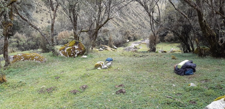
Reaching the third camping site has been one of the most difficult moments of my trek (but not THE most difficult moment right?)! It was further than I thought from the previous one (approximately 1.5 kilometers away, see pictures below), I was beginning to stumble on the rocks (not that the path was difficult, but simply because I was exhausted), and in the end I looked at the GPS for the distance that remained, converted that into a number of steps, and started counting my steps in order not to think about tiredness! Kind of weird I have to admit…but I’ve always done things like that: I sometimes count in order to fall asleep also, and I’m not counting sheeps as we tell little children to do, I count the seconds passing… Anyway… 😆
Picture taken from my camping site. 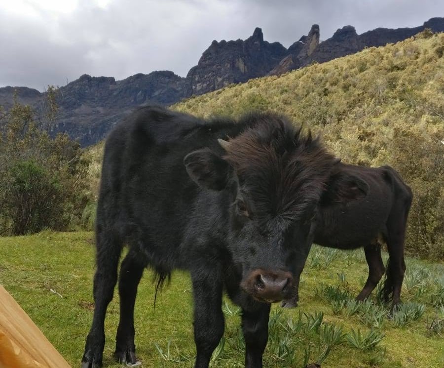
Photo Credit: The mystery photographer once again!
It took me 190 steps to reach the camping site if I remember correctly, and I even went past it at first because it really seemed insignificant compared to the previous ones.
You already know what comes next: I put up the tent and it was easier than I thought, I collapsed into it, and then I started writing in the diary. But since this article is becoming quite long, I suggest we stop here, with the pictures of my one-night dwelling. And I’ll tell you about the remaining 3 days another time! Okay? … Of course since you don’t have a choice!

To be continued…
PS: One last thing before I leave you though! If you feel a little disappointed with not seeing splendid pictures of the mountains, mountain lakes, and glaciers I told you about: don’t worry, they’re coming in the second part of the article! It’s just that we’ve only reached the first day and the most impressive landscapes showed up on the following ones (and also that in the beginning I was trying to save the battery of my cell phone, which I used mainly as a GPS, since I left without bringing a map). In addition, I really thought these prerequesites were necessary for you to understand my state of my mind when I went into the trek 🙂
Disclaimer: For this article as well as any other article written in a foreign language (that is, not in French, from my point of view — but I could as well have said every article written in English or Spanish, since I doubt I will learn yet another language during this trip…mastering Spanish would already be very cool and I’d consider it a victory!), I’ll allow myself to significantly rephrase parts of the article if I after publishing I find something that I’m actually not satisfied with, or if one of my careful readers (and I know some will be 😉 ) come up with relevant improvement suggestions. So don’t be surprised if this article seems a little different from the previous time you’ve been here, if for some reason you’re reading it again. Even this disclaimer could be updated!
